

Safe Routing
Define and distribute operationally approved routes and safe corridors for field personnel.
- Admin-defined safe corridors
- Controlled operational routes
- Restricted-area awareness
- Private roads and tracks


Security & High-Risk Navigation for Disconnected Environments.
A specialized safety platform for organizations operating in high-risk, remote, and disconnected environments, combining sovereign navigation, safe routing, safety protocols, and offline operational continuity.
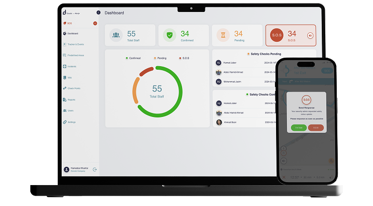
DoSafe
DoSafe is designed for organizations that need to control how personnel move through remote, high-risk, or restricted environments without depending entirely on commercial mapping and connectivity infrastructure.
“Your operation defines the safe route — not a third-party map.”
Core Capabilities
DoSafe combines organization-defined safe routes, sovereign navigation, operational safety protocols, offline functionality, and emergency communication into one platform.
Define and distribute operationally approved routes and safe corridors for field personnel.
Provide turn-by-turn navigation using custom roads, routes, and geo-sites defined for the organization's operational environment.
Support structured safety procedures for personnel operating across remote or high-risk environments.
Provide personnel with mechanisms to trigger emergency notifications and communicate critical information.
Core operational functions can continue even when connectivity is temporarily unavailable.
Administrators define the operational map and the geographic information that personnel should use.
Safe Routing Engine
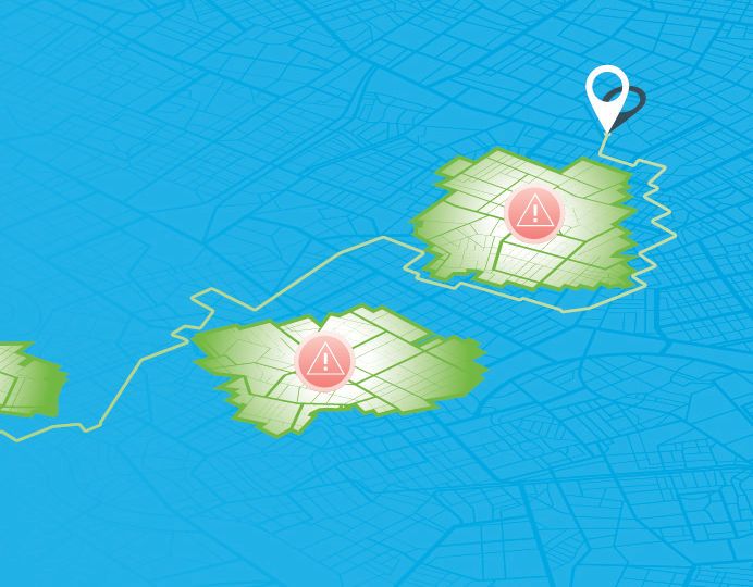
DoSafe allows organizations to define the geographic environment that personnel should navigate within, including safe corridors, private roads, concessions, desert tracks, secure sites, and other operational routes.
Define the routes and corridors that field teams should use for operational movement — custom safe paths, operational corridors, private access routes and controlled geographic layers.
Guide personnel along organization-defined routes using offline navigation designed for remote and disconnected environments.
Map Authority
DoSafe allows organizations to maintain their own operational geographic environment rather than relying solely on generic public mapping.
Create and maintain routes that reflect the actual physical environment, including private roads and tracks that may not be represented accurately in commercial mapping platforms.
Represent concessions, operational sites, secure areas, and other organization-defined locations within the operational map.
Safety Workflow
DoSafe brings safe routing, navigation, personnel status, safety protocols, and emergency communication into a connected operational workflow.
Safety Protocols
DoSafe provides a digital environment for defined safety procedures, personnel check-ins, emergency triggers, and internal security information.
Establish scheduled personnel check-ins to support operational awareness during remote or high-risk activities.
Allow personnel to initiate an emergency signal that can be surfaced to the relevant operational team.
Support emergency communication and broadcast messaging across the operational environment.
Keep approved internal safety and security procedures accessible to field personnel.
API-Enabled Safety Intelligence
DoSafe provides API access for applications and systems that need personnel location, safety status, mapping data, or operational reports.
Standard monitoring information for systems that need real-time personnel and safety status.
Extended access for organizations that need map data, reports, and custom operational integration.
Designed for High-Risk Operations
DoSafe is positioned for organizations whose teams operate across remote, high-risk, or infrastructure-constrained environments.
Support personnel safety and navigation across concessions, remote sites, and operational routes.
Provide field teams with safety workflows and operational navigation in challenging environments.
Support controlled geographic environments and operational safety requirements.
Maintain operational awareness where connectivity and mapping availability can be limited.
Use organization-defined routes, geo-sites, and safety procedures.
Continue core safety operations through offline functionality and Store & Forward.
Let's discuss your routes, sites, safe-navigation requirements, and field safety procedures.